Related Articles
- Direct solar FTIR measurements of CO₂ and HCl in the plume of Popocatépetl Volcano, Mexico
- Combined direct-sun ultraviolet and infrared spectroscopies at Popocatépetl volcano (Mexico)
- Variability in the Gas Composition of the Popocatépetl Volcanic Plume
- Characterization of a UV camera system for SO₂ measurements from Popocatépetl Volcano
- Continuous measurements of SiF₄ and SO₂ by thermal emission spectroscopy: Insight from a 6-month survey at the Popocatépetl volcano
- Volcanic SO₂ and SiF₄ visualization using 2-D thermal emission spectroscopy – Part 2: Wind propagation and emission rates
- Volcanic SO₂ and SiF₄ visualization using 2-D thermal emission spectroscopy – Part 1: Slant-columns and their ratios
- Gas composition of Popocatépetl Volcano between 2007 and 2008: FTIR spectroscopic measurements of an explosive event and during quiescent degassing
- SO₂ emissions from Popocatépetl volcano: emission rates and plume imaging using optical remote sensing techniques
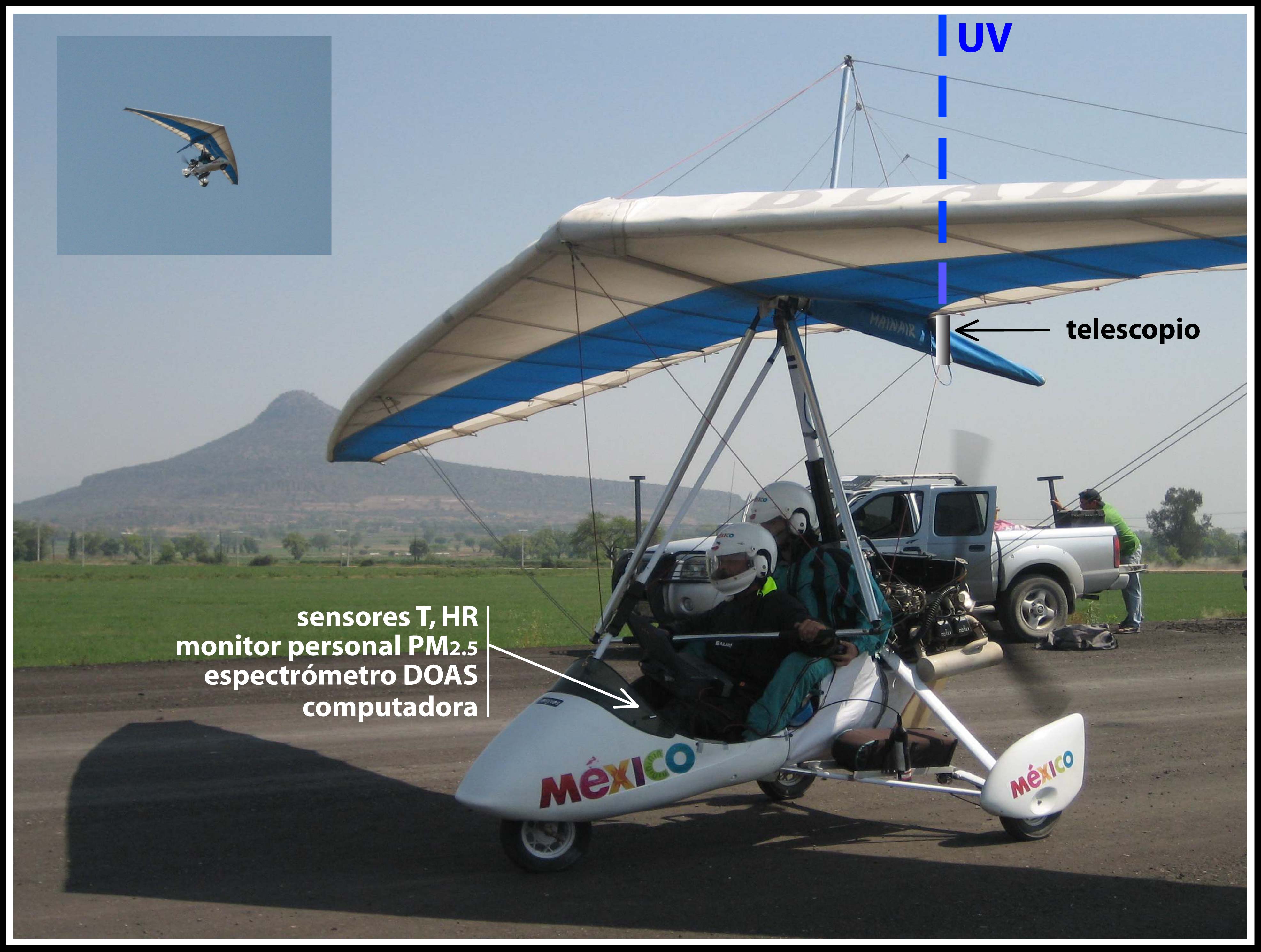
Passive DOAS installed on an ultra-light aircraft
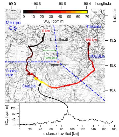
Map of the region around the Popocatepetl volcano showing
the results from a DOAS measurement made on board an ultra-light
aircraft. The color scaled line represents the slant column of SO2
(ppm×m)measured along the path flow on 18th March 2006